Rongai at a glance
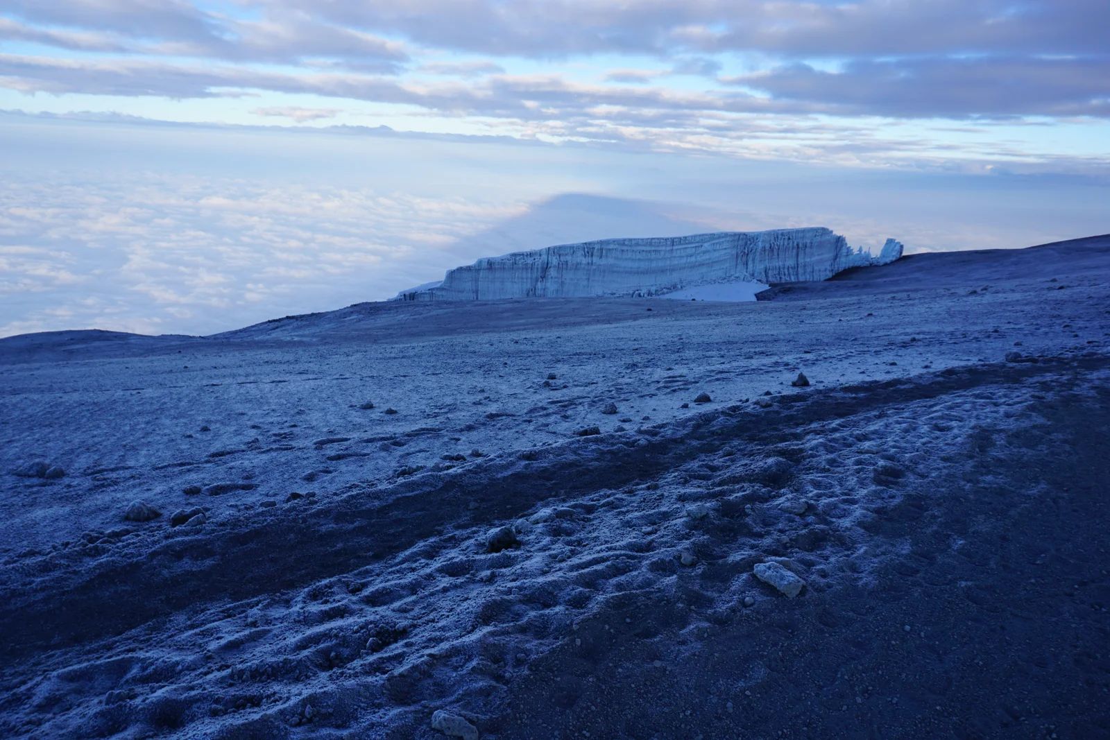
Approach Kilimanjaro from the north on a seven-day camping itinerary, with open mountain country and a generally quieter ascent. The route moves towards Mawenzi Tarn before crossing to Kibo, then descends on the Marangu side. Rongai appeals to hikers who value a different perspective and a less busy approach.
Why choose Rongai?
- A deliberate pause at Mawenzi Tarn
- Two nights at Mawenzi Tarn create time for a guide-led acclimatisation outing and recovery before the move towards Kibo.
- Northern scenery and Mawenzi views
- Begin through farmland and forest, then climb into open moorland and the dramatic setting beneath Mawenzi. Descending through the Marangu corridor lets you experience a different side of the mountain.
- A quieter ascent without the Barranco Wall
- Rongai suits hikers who prefer the northern approach and want to avoid the Barranco Wall. The early walking is gentler in character, but the summit ascent from Kibo is still long and demanding.
Extra time supports acclimatisation; it does not guarantee a summit. Read our altitude and acclimatisation guidance →
- Mountain time
- 7 trekking days · 6 mountain nights
- Approach & finish
- North approach · Marangu Gate finish
- Summit
- Uhuru Peak · 5,895 m
- Sleeping
- Camping
- Trail atmosphere
- Generally quieter on the ascent
- Physical demand
- Challenging; gentler approach
Less varied scenery than the western routes, plus a longer trailhead transfer. A gentler approach does not make summit night easy.
Mountain days run from the first trailhead walk to the exit gate, including acclimatisation days. Arrival, hotel preparation, post-climb rest and departure are additional.
The route on the mountain
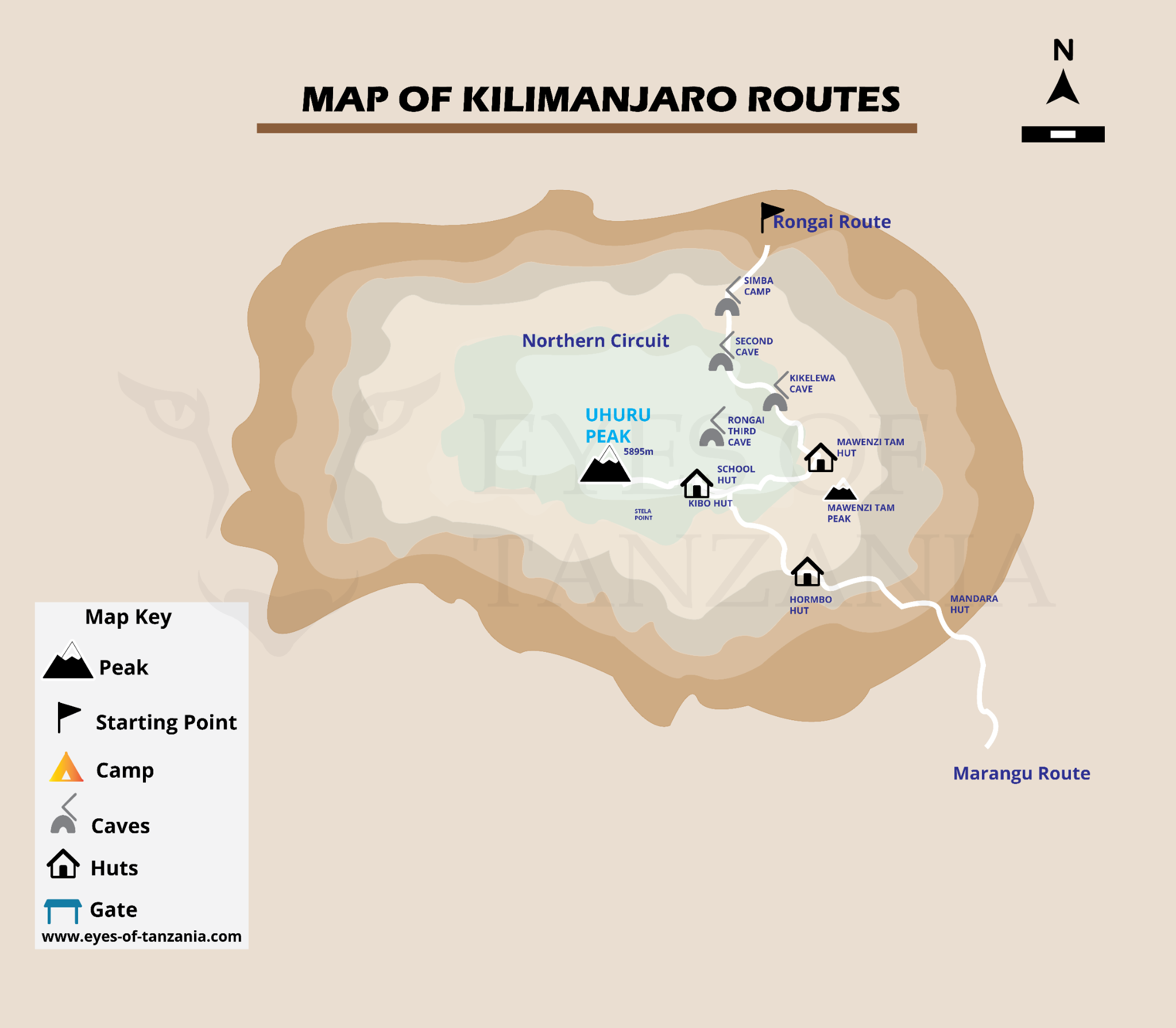
Company schematics provide orientation, not navigation instructions. Hut icons and artwork labels do not define booked sleeping arrangements.
7-day Rongai itinerary
A detailed sample mountain itinerary, to help you understand the experience before agreeing your operating schedule.
Elevations, distances and times are approximate planning figures, not promises. Published camp elevations vary; pace, weather, trail choice and acclimatisation outings change the day. The team confirms camps and stages before booking.
- Mountain day 1
Rongai Gate → Rongai Cave / Simba area
Travel to the northern trailhead before walking through farmland and forest. This side of the mountain offers a different first impression from the western plateau routes. Published first-camp names and elevations vary; the sample uses the Rongai Cave stage from the verification source. Confirm the exact first-night campsite with the team.
- Start
- ≈ 1,950 m
- Finish
- ≈ 2,835 m
- Distance
- ≈ 8 km
- Trekking time
- 3–4 hours
- Habitat
- Farmland → montane forest
- Overnight
- Rongai Cave / Simba camp area · tent
- Mountain day 2
Rongai Cave → Second Cave → Kikelewa
Walk steadily upwards to Second Cave, then leave the main northern line towards the Mawenzi side. In this outline Second Cave is a daytime waypoint, not a separate overnight stop. The combined stage is longer than company variants that split it over two days. Arrive at Kikelewa with time to eat and recover.
- Start
- ≈ 2,835 m
- Finish
- ≈ 3,600 m
- Distance
- ≈ 12 km
- Trekking time
- 6–8 hours
- Habitat
- Heath & moorland
- Overnight
- Kikelewa camp
- Mountain day 3
Kikelewa → Mawenzi Tarn
A shorter but steeper stage brings you beneath Mawenzi’s jagged skyline. Grass and heath give way to bare mountain terrain as you approach the tarn area. Treat the afternoon as recovery time rather than a reason to race upwards. The camp’s dramatic surroundings make this one of the distinctive stops on the northern approach.
- Start
- ≈ 3,600 m
- Finish
- ≈ 4,315 m
- Distance
- ≈ 5 km
- Trekking time
- 3–4 hours
- Habitat
- Moorland → alpine desert
- Overnight
- Mawenzi Tarn camp
- Mountain day 4
Mawenzi acclimatisation outing → Mawenzi Tarn
Remain at Mawenzi Tarn for a second night. A guide-led walk onto Mawenzi Ridge gives an opportunity to move higher and return to the same sleeping camp. The outing length is adjusted to conditions and the group; the extra day should support recovery as well as walking. It is not a climb of Mawenzi’s technical summit.
- Start
- ≈ 4,315 m
- Finish
- ≈ 4,315 m
- Reported high point
- ≈ 4,390 m
- Distance
- ≈ About 4 km, outing-dependent
- Trekking time
- 2–4 hours
- Habitat
- Alpine desert
- Overnight
- Mawenzi Tarn camp · second night
- Mountain day 5
Mawenzi Tarn → Kibo
Cross the wide saddle from Mawenzi towards Kibo. Exposed ground and an increasingly stark horizon define this stage. Arrive near Kibo, organise the summit kit and rest before the night ascent. This camping route does not automatically include dormitory beds merely because the campsite lies beside Kibo Hut.
- Start
- ≈ 4,315 m
- Finish
- ≈ 4,700 m
- Distance
- ≈ 8–9 km
- Trekking time
- 5–6 hours
- Habitat
- Alpine desert
- Overnight
- Kibo area · camping
- Mountain day 6
Kibo → Uhuru Peak → Horombo
A night ascent climbs the steep upper slopes towards Gilman’s Point. The crater-rim traverse to Uhuru adds effort after reaching the rim; conditions and the guide’s assessment determine how far to proceed. Descend back to Kibo for a break, then continue to Horombo. This very long day requires energy for the return as well as the climb.
- Start
- ≈ 4,700 m
- Finish
- ≈ 3,720 m
- Reported high point
- 5,895 m
- Distance
- ≈ 6 km up + 16 km down
- Trekking time
- 7–9 hours up + 4–6 hours down
- Habitat
- Alpine desert → summit zone → moorland
- Overnight
- Horombo area · camping
- Mountain day 7
Horombo Hut → Marangu Gate
Retrace the lower Marangu trail through Mandara and back into forest. The distance is considerable even though most of it is downhill. Walk carefully on damp surfaces and give your knees time. Finish at Marangu Gate, not Mweka, before the separately arranged return transfer and post-climb night.
- Start
- ≈ 3,720 m
- Finish
- ≈ 1,860 m
- Distance
- ≈ 20 km
- Trekking time
- 5–7 hours
- Habitat
- Moorland → montane forest
- Overnight
- Off the mountain; hotel separately arranged
Elevation & acclimatisation
This version combines Second Cave and Kikelewa on day two and includes two nights at Mawenzi Tarn. The older company seven-day itinerary instead splits the approach over more camps. Both are northern-route variations; the final camp sequence must be agreed before booking.
This joins published overnight values. It is not a GPS track, continuous terrain profile or assessment of medical safety.
Fitness does not protect against altitude illness. A slower ascent can help adaptation, but any Kilimanjaro itinerary still reaches very high altitude. Report symptoms promptly and follow your guide’s decisions; never continue higher with worsening symptoms.
Understand altitude before you climbCamps, huts & mountain nights
Six mountain nights under canvas in this sample, including the Kibo and Horombo areas.
Rongai is a camping route. A hut label on a map or itinerary does not confirm a reserved bed; request any accommodation change explicitly.
What mountain accommodation is really likeThe landscapes you’ll cross
- 01Northern farmland and forest.
- 02Open heath, moorland and the ridges below Mawenzi.
- 03The tarn area and the bare saddle to Kibo.
- 04The eastern summit rim, followed by Marangu’s moorland and forest descent.
What to know before choosing
- The northern trailhead requires a longer transfer; confirm road time in the travel plan.
- The supplied company map shows a Third Cave / School Hut variant, rather than this Mawenzi Tarn / Kibo sequence.
- Rongai is often relatively drier, but rain, snow and cold remain possible; pack full weather protection.
Prepare for this route
Train for the long combined second stage and the very long summit descent. Prepare for camping throughout, including near huts. Keep documents and valuables in your daypack for the cross-mountain finish at Marangu Gate.
What your climb quote should cover
Request a personalised quote for this route, based on your group size and preferred dates.
Confirm in the mountain package
- Park fees and camping arrangements.
- Guides, porters, cook, mountain meals and drinking-water treatment.
- Tents, sleeping mats and dining / toilet equipment.
- Emergency equipment, monitoring and descent arrangements.
- Hotel nights, airport transfers and trailhead transport.
Budget separately unless included
- Flights, entry documents and appropriate travel insurance.
- Personal kit, sleeping bag and any gear rental.
- Crew tips and personal spending.
- Extra hotel nights, itinerary changes and extensions.
These are quote-checking categories, not confirmed company inclusions. Request a written itemisation and booking terms.
Plan my Rongai climbUnderstand the full climb budget