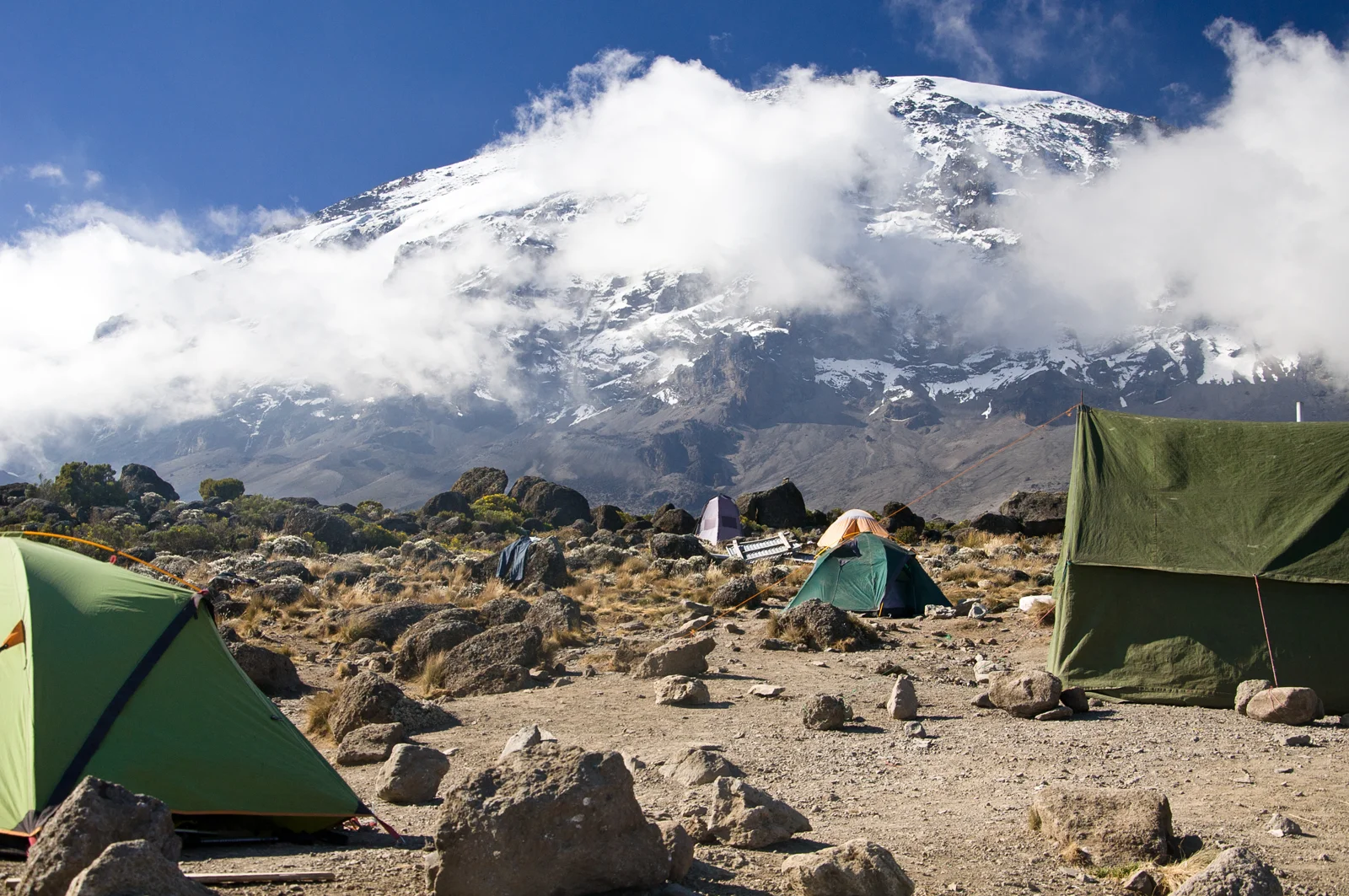
Umbwe at a glance
Umbwe offers a direct southern ascent through steep forest and ridges before joining the southern circuit at Barranco. Our seven-day outline includes a second Barranco night before continuing towards Karanga and Barafu. It is a route for experienced hikers who value a quieter beginning and will discuss their altitude experience with the mountain team.
Why choose Umbwe?
- A steep, distinctive opening
- The first two days climb directly through forest and onto the southern slopes. This gives Umbwe its immediate mountain character and a generally quieter start before joining the shared trail at Barranco.
- An extra Barranco night
- The seven-day outline includes an additional Barranco day for adjustment and recovery. It does not undo the rapid early ascent.
- For experience, rather than speed
- Choose Umbwe for its terrain and direct approach, not as a shortcut to the summit. Strong fitness alone does not establish altitude readiness; our team should assess your experience before recommending this route.
Extra time supports acclimatisation; it does not guarantee a summit. Read our altitude and acclimatisation guidance →
- Mountain time
- 7 trekking days · 6 mountain nights
- Approach & finish
- South approach · Mweka Gate finish
- Summit
- Uhuru Peak · 5,895 m
- Sleeping
- Camping
- Trail atmosphere
- Quiet initially; joins southern circuit
- Physical demand
- Very challenging; steep early ascent
The fast early ascent leaves less time to adapt. Fitness alone does not predict how you will respond to altitude.
Mountain days run from the first trailhead walk to the exit gate, including acclimatisation days. Arrival, hotel preparation, post-climb rest and departure are additional.
The route on the mountain
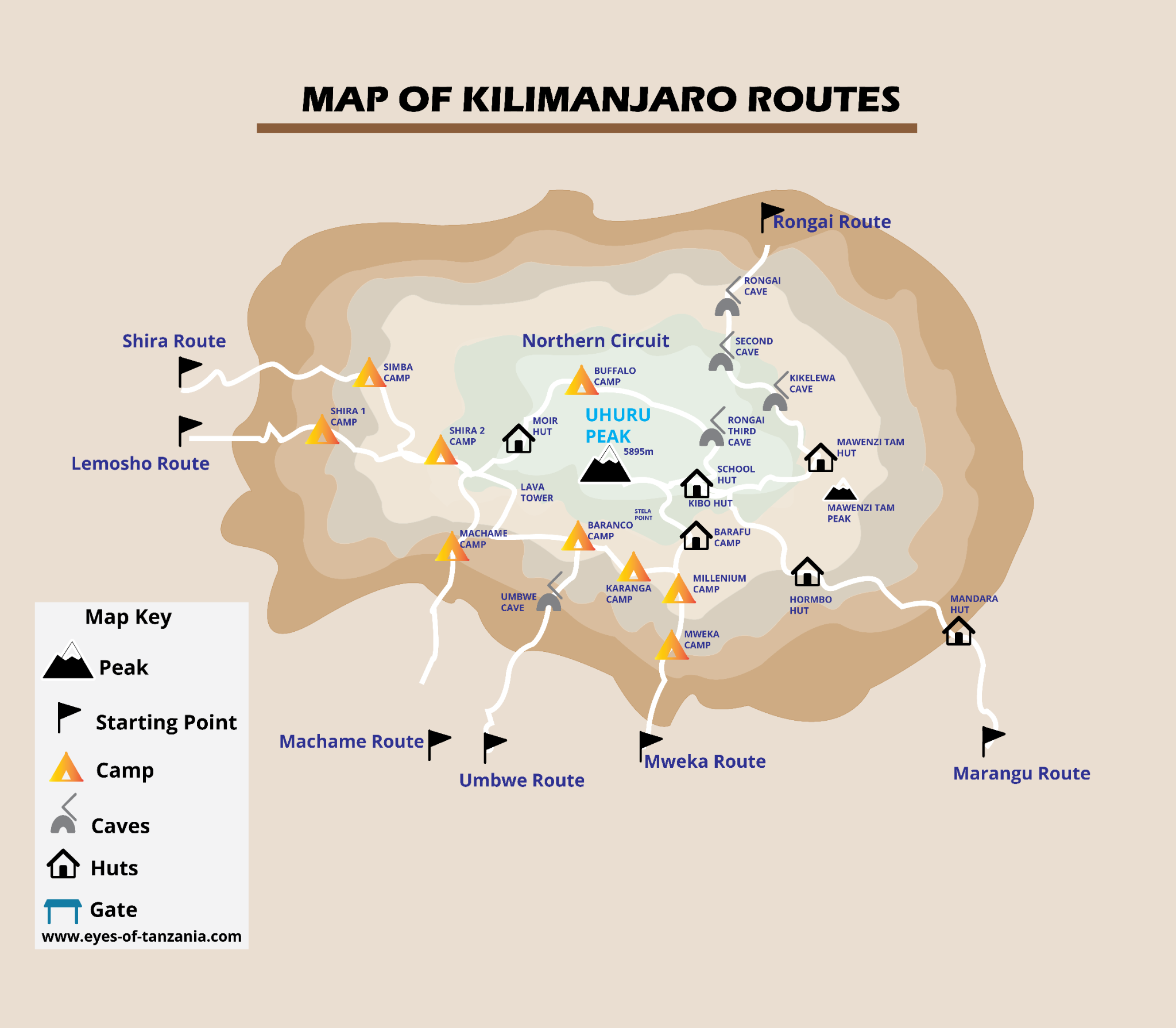
Company schematics provide orientation, not navigation instructions. Hut icons and artwork labels do not define booked sleeping arrangements.
7-day Umbwe itinerary
A detailed sample mountain itinerary, to help you understand the experience before agreeing your operating schedule.
Elevations, distances and times are approximate planning figures, not promises. Published camp elevations vary; pace, weather, trail choice and acclimatisation outings change the day. The team confirms camps and stages before booking.
- Mountain day 1
Umbwe Gate → Umbwe camp
A steep forest approach establishes the route’s direct character immediately. Expect sustained uphill walking on a narrow path rather than the gradual plateau introduction of Lemosho. Maintain a controlled pace and be comfortable with uneven footing. This is an experienced-hiker option that needs careful assessment before being shortlisted.
- Start
- ≈ 1,600 m
- Finish
- ≈ 2,900 m
- Distance
- ≈ 11 km
- Trekking time
- 5–7 hours
- Habitat
- Montane forest
- Overnight
- Umbwe camp
- Mountain day 2
Umbwe camp → Barranco
Continue climbing quickly towards the southern side of Kibo. As the forest thins, steeper ridges and more exposed-feeling ground lead into the Barranco Valley. The large change in sleeping altitude is a central concern on Umbwe: strong legs are not a substitute for adaptation. Tell the team promptly about any symptoms.
- Start
- ≈ 2,900 m
- Finish
- ≈ 3,975 m
- Distance
- ≈ 6 km
- Trekking time
- 4–5 hours
- Habitat
- Forest → heath & moorland
- Overnight
- Barranco camp
- Mountain day 3
Acclimatisation day at Barranco
This seven-day variation keeps another night at Barranco before moving east. A short walk or recovery period is chosen by the guide according to the group and conditions. No fixed high point or kilometre target is promised. The additional day does not undo the rapid initial ascent or turn Umbwe into a routine first choice.
- Start
- ≈ 3,975 m
- Finish
- ≈ 3,975 m
- Distance
- ≈ Guide-led outing; distance to confirm
- Trekking time
- Adjusted to the group
- Habitat
- Moorland & alpine desert
- Overnight
- Barranco camp · second night
- Mountain day 4
Barranco Wall → Karanga
The morning begins with the Barranco Wall. This is a steep scrambling section where hands help with balance, with exposed-feeling passages and potential queues. Follow your guide’s instructions and keep poles stowed where advised. Beyond the wall, the route crosses uneven ridges and drops into Karanga Valley before climbing to camp.
- Start
- ≈ 3,975 m
- Finish
- ≈ 3,995 m
- Distance
- ≈ 5 km
- Trekking time
- 4–5 hours
- Habitat
- Rocky moorland & alpine desert
- Overnight
- Karanga camp
- Mountain day 5
Karanga → Barafu
Vegetation is sparse and the approach becomes increasingly rocky. A relatively short distance still feels significant in thin air. Arrive, organise summit layers and headlamp, eat and rest before the night ascent. Barafu is an exposed camping area; choose stable footing and ask your guide before wandering away from camp.
- Start
- ≈ 3,995 m
- Finish
- ≈ 4,670 m
- Distance
- ≈ 4 km
- Trekking time
- 4–5 hours
- Habitat
- Alpine desert
- Overnight
- Barafu camp
- Mountain day 6
Barafu → Uhuru Peak → Mweka
Typically starting around midnight, climb slowly through cold, dark conditions towards Stella Point and then along the crater rim to Uhuru Peak. Reaching the summit is only part of the day: descend to Barafu for a break, then continue far down to Mweka. The sustained descent demands concentration and tired-leg control. The team decides whether conditions and your health allow continued ascent.
- Start
- ≈ 4,670 m
- Finish
- ≈ 3,070 m
- Reported high point
- 5,895 m
- Distance
- ≈ 5 km up + 12 km down
- Trekking time
- 6–8 hours up + 4–6 hours down
- Habitat
- Alpine desert → summit zone → forest
- Overnight
- Mweka camp
- Mountain day 7
Mweka camp → Mweka Gate
The final trail returns through wetter forest and can be muddy even after dry days higher up. Take care on roots and slippery steps. At the gate, complete park formalities and meet your transfer. A shower, a proper rest and a separate hotel night make a better finish than squeezing a long journey into the same afternoon.
- Start
- ≈ 3,070 m
- Finish
- ≈ 1,640 m
- Distance
- ≈ 10 km
- Trekking time
- 3–4 hours
- Habitat
- Montane forest
- Overnight
- Off the mountain; hotel separately arranged
Elevation & acclimatisation
The first two stages gain sleeping altitude rapidly. The added Barranco day creates time at one camp, but the initial profile remains steep. Umbwe is deliberately excluded from automatic route-finder recommendations; discuss a slower alternative before treating it as a way to save time.
This joins published overnight values. It is not a GPS track, continuous terrain profile or assessment of medical safety.
Fitness does not protect against altitude illness. A slower ascent can help adaptation, but any Kilimanjaro itinerary still reaches very high altitude. Report symptoms promptly and follow your guide’s decisions; never continue higher with worsening symptoms.
Understand altitude before you climbCamps, huts & mountain nights
Six mountain nights in tents, including two at Barranco in this seven-day variation.
The southern stages share the same Karanga, Barafu and Mweka areas as other camping routes.
What mountain accommodation is really likeThe landscapes you’ll cross
- 01Dense southern forest and steep ridges.
- 02Rapid transition to the Barranco Valley.
- 03The Barranco Wall and southern volcanic slopes.
- 04The Barafu summit approach and Mweka forest descent.
What to know before choosing
- Low visitor numbers do not make a rapid ascent safer.
- Steep, uneven and exposed-feeling ground demands confident footing.
- The seven-day outline must be assessed by the operating team before it becomes a proposed climb.
Prepare for this route
Bring substantial multi-day hiking experience and practise steep ascents, careful descents and daypack handling. Talk through past altitude experience with the team and a qualified clinician. Compare Lemosho or Machame if the direct ascent is not appropriate.
What your climb quote should cover
Request a personalised quote for this route, based on your group size and preferred dates.
Confirm in the mountain package
- Park fees and camping arrangements.
- Guides, porters, cook, mountain meals and drinking-water treatment.
- Tents, sleeping mats and dining / toilet equipment.
- Emergency equipment, monitoring and descent arrangements.
- Hotel nights, airport transfers and trailhead transport.
Budget separately unless included
- Flights, entry documents and appropriate travel insurance.
- Personal kit, sleeping bag and any gear rental.
- Crew tips and personal spending.
- Extra hotel nights, itinerary changes and extensions.
These are quote-checking categories, not confirmed company inclusions. Request a written itemisation and booking terms.
Plan my Umbwe climbUnderstand the full climb budget